-
×
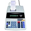 Sharp EL-1197PIII Heavy Duty Color Printing Calculator with Clock and Calendar
1 × $64.97
Sharp EL-1197PIII Heavy Duty Color Printing Calculator with Clock and Calendar
1 × $64.97 -
×
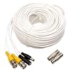 Q-See QS100B | UL Rated E475392 Video & Power Cable | Extend Your Original Camera Cable | Prevent Video Loss & Interference | 100 ft BNC Male Cable with 2 Female Connectors
1 × $14.97
Q-See QS100B | UL Rated E475392 Video & Power Cable | Extend Your Original Camera Cable | Prevent Video Loss & Interference | 100 ft BNC Male Cable with 2 Female Connectors
1 × $14.97 -
×
 ECHOGEAR Full Motion Articulating TV Wall Mount Bracket for TVs Up to 75" - Extends from The Wall 16" with Smooth Swivel & Tilt - Simple 3-Step Install
1 × $64.79
ECHOGEAR Full Motion Articulating TV Wall Mount Bracket for TVs Up to 75" - Extends from The Wall 16" with Smooth Swivel & Tilt - Simple 3-Step Install
1 × $64.79 -
×
 Trianium (3 Packs) Screen Protector Designed for Apple iPhone XS & iPhone X 2018 2017 Premium HD CLARITY 0.25mm Tempered Glass Screen Protector with Alignment Case Frame [3D Touch] (3-Pack)
1 × $9.95
Trianium (3 Packs) Screen Protector Designed for Apple iPhone XS & iPhone X 2018 2017 Premium HD CLARITY 0.25mm Tempered Glass Screen Protector with Alignment Case Frame [3D Touch] (3-Pack)
1 × $9.95 -
×
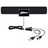 TV Antenna Signal Receiver,Ahere HDTV Receiver for Digital TV Indoor 50 Mile Range with Detachable Amplifier Signal Booster,USB Powered HD Receiver Antenna with 10ft High Performance Coax Cable
1 × $19.99
TV Antenna Signal Receiver,Ahere HDTV Receiver for Digital TV Indoor 50 Mile Range with Detachable Amplifier Signal Booster,USB Powered HD Receiver Antenna with 10ft High Performance Coax Cable
1 × $19.99 -
×
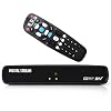 DIGITAL STREAM DTX9980 Analog Pass-through DTV Converter Box, Full ATSC, Dolby
1 × $26.99
DIGITAL STREAM DTX9980 Analog Pass-through DTV Converter Box, Full ATSC, Dolby
1 × $26.99 -
×
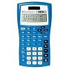 Texas Instruments TI30XIIS Blue Scientific Calculator
1 × $23.18
Texas Instruments TI30XIIS Blue Scientific Calculator
1 × $23.18 -
×
 Tyler Portable Neon Pink Stereo CD Player with AM/FM Radio and Aux & Headphone Jack Line-In (TAU105-NPK)
1 × $29.95
Tyler Portable Neon Pink Stereo CD Player with AM/FM Radio and Aux & Headphone Jack Line-In (TAU105-NPK)
1 × $29.95 -
×
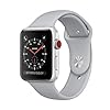 Apple Watch Series 3 Aluminum Case Sport 42mm GPS + Cellular GSM Unlocked (Silver Aluminum Case with Fog Sport Band)
1 × $459.95
Apple Watch Series 3 Aluminum Case Sport 42mm GPS + Cellular GSM Unlocked (Silver Aluminum Case with Fog Sport Band)
1 × $459.95 -
×
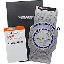
 Garmin aera660 Touchscreen Aviation GPS Portable
1 × $749.00
Garmin aera660 Touchscreen Aviation GPS Portable
1 × $749.00 -
×
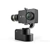 YI Gimbal 3-Axis Handheld Stabilizer for Yi Lite, 4K, 4K+ and Other Action Cameras (Gimbal Only)
1 × $69.99
YI Gimbal 3-Axis Handheld Stabilizer for Yi Lite, 4K, 4K+ and Other Action Cameras (Gimbal Only)
1 × $69.99 -
×
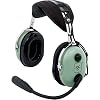 David Clark H10-13S Stereo Headset
1 × $342.47
David Clark H10-13S Stereo Headset
1 × $342.47
Subtotal: $1,876.20