-
×
 Intel BX80677G3930 7th Gen Celeron Desktop Processors
1 × $250.00
Intel BX80677G3930 7th Gen Celeron Desktop Processors
1 × $250.00 -
×
 Jeppesen Professional Pilot Logbook
1 × $24.39
Jeppesen Professional Pilot Logbook
1 × $24.39 -
×
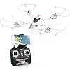 DBPOWER X400W FPV RC Quadcopter Drone with WiFi Camera Live Video One Key Return Function Headless Mode 2.4GHz 4 Chanel 6 Axis Gyro RTF, Compatible with 3D VR Headset
1 × $59.99
DBPOWER X400W FPV RC Quadcopter Drone with WiFi Camera Live Video One Key Return Function Headless Mode 2.4GHz 4 Chanel 6 Axis Gyro RTF, Compatible with 3D VR Headset
1 × $59.99 -
×
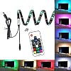 EveShine Neon Accent LED Strips Bias Backlight RGB Lights with Remote Control for HDTV, Flat Screen TV Accessories and Desktop PC, Multi Color
1 × $10.99
EveShine Neon Accent LED Strips Bias Backlight RGB Lights with Remote Control for HDTV, Flat Screen TV Accessories and Desktop PC, Multi Color
1 × $10.99 -
×
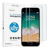 OMOTON SmoothArmor 9H Hardness HD Tempered Glass Screen Protector for Apple iPhone 8 Plus/iPhone 7 Plus, 2 Pack
1 × $5.99
OMOTON SmoothArmor 9H Hardness HD Tempered Glass Screen Protector for Apple iPhone 8 Plus/iPhone 7 Plus, 2 Pack
1 × $5.99 -
×
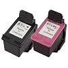 Original HP 61 Black/Tri-color Ink (2-pack) | Works with DeskJet 1000, 1010, 1050, 1510, 2050, 2510, 2540, 3000, 3050…
1 × $52.99
Original HP 61 Black/Tri-color Ink (2-pack) | Works with DeskJet 1000, 1010, 1050, 1510, 2050, 2510, 2540, 3000, 3050…
1 × $52.99 -
×
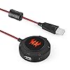 External USB Sound Card, VersionTech Stereo Headset Adapter for PC, Laptops, PS4 and Xbox, Plug and Play USB Hub for Windows, Vista, Mac and iOS -Red
1 × $19.99
External USB Sound Card, VersionTech Stereo Headset Adapter for PC, Laptops, PS4 and Xbox, Plug and Play USB Hub for Windows, Vista, Mac and iOS -Red
1 × $19.99 -
×
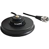 Browning WSPBR10353 5/8 NMO Mount Magnet
1 × $25.94
Browning WSPBR10353 5/8 NMO Mount Magnet
1 × $25.94 -
×
 Viewtv AT-163 ATSC Digital TV Converter Box and Media Player w/ Recording PVR Function / HDMI Out / Coaxial Out / Composite Out / USB Input
1 × $34.99
Viewtv AT-163 ATSC Digital TV Converter Box and Media Player w/ Recording PVR Function / HDMI Out / Coaxial Out / Composite Out / USB Input
1 × $34.99
Subtotal: $485.27